
Quang Thanh Bridge crosses the Van Uc River between the An Lao side of Hai Phong and the Thanh Ha countryside, formerly in Hai Duong. It is a working road crossing that replaced the Quang Thanh ferry, useful when your journey takes you between these areas.
For travelers, it makes more sense as part of a countryside route than as a destination around which to build a day trip. You can appreciate the river setting while passing through, but plan any stop around road conditions and a suitable place off the carriageway.
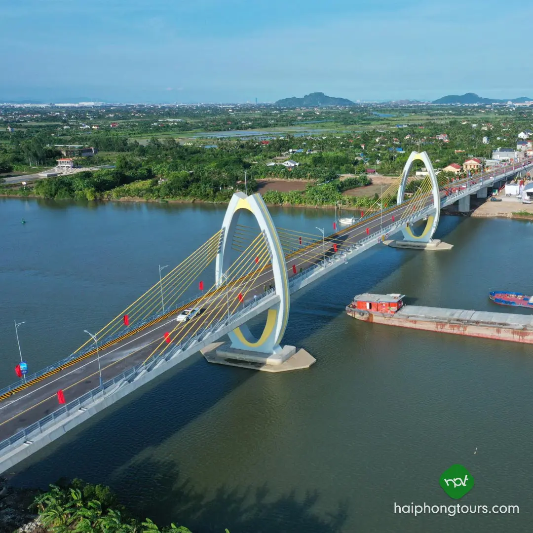
Where is Quang Thanh Bridge?
The bridge is inland from central Hai Phong, on the connection between the former An Lao and Thanh Ha districts. Both sides are now within Hai Phong. Older maps and articles may still show Hai Duong on the Thanh Ha side.
The An Lao approach runs through An Quang commune along the road toward Quang Thanh crossroads. The crossing connects the Provincial Road 360 side with the road network toward Provincial Road 390 and Thanh Ha. Search for Cầu Quang Thanh and check that the map pin is on the Van Uc River, rather than at a similarly named business or crossroads.
Why the bridge matters locally
Quang Thanh Bridge was inaugurated on July 17, 2021, several years before the administrative merger of Hai Duong and Hai Phong. It replaced the ferry of the same name, removing the need to wait for that crossing on this route.
The reinforced and prestressed concrete bridge is approximately 536 meters long and 12 meters wide, with 10 spans. Its main significance is practical: it connects communities, workplaces and agricultural trade on opposite banks.
For the Thanh Ha countryside, the road link has made it easier for growers and traders to transport produce, including lychees, and for residents to commute toward Hai Phong. That everyday connection explains the bridge’s role better than treating it as a purpose-built sightseeing attraction.
Getting there and deciding whether to stop
Use your actual starting point and next destination to choose the route. A journey from central Hai Phong, an airport hotel or a village in Thanh Ha will not take the same time. Check live directions and road signs rather than relying on a fixed “30-minute drive” estimate.
- By car or taxi: give the driver your final destination as well as the bridge pin. Agree on waiting and onward travel if you want a countryside stop.
- If stopping for a view: use a place where stopping is permitted and you can remain clear of moving traffic. Do not stop a vehicle on the bridge merely to take a photograph.
- During poor weather: follow any current traffic restrictions and avoid exposed roadside stops.
Do not assume that the bridge provides visitor parking, a designated viewpoint or an organized walking route. If there is no suitable place to stop, continue across and enjoy the view as a passenger.
Planning the rest of your countryside trip
Choose your main village, garden, family visit or business stop first, then see whether Quang Thanh Bridge belongs on that route. Confirm access with your host before traveling; a road connection does not mean a private garden or working property welcomes unannounced visitors.
For a temple or other attraction farther across Hai Phong, check its location separately. Sharing the same city boundary does not make places close together, and crossing this bridge is not necessary for every trip into the former Hai Duong area.